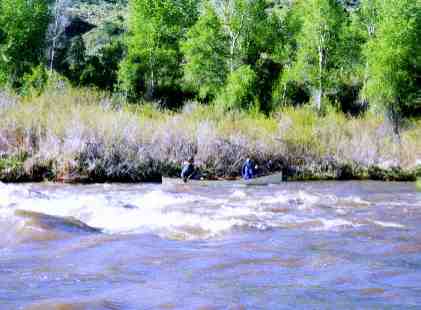

Best time to paddle the White River is May and June. Here are the typical runs:
- Confluence of the North Fork and South Fork to Meeker City Park. 10 miles. Some haystacks and waves. Swift water. Class II+ and possible seasonal hazards like trees across river..
- Meeker City Park to Rio Blanco Lake. 20 miles through private ranchland. Class II. Camping available in Meeker City Park. Camping available at RioBlanco Lake. River access is at east side of lake and downstream of the boulder dam. (Some bushwhacking required. Click here for some pictures of launching at Rio Blanco Lake)
- RioBlanco Lake to bridge at city road 65 or Kenney Reservoir. 38 miles. Class II through private ranchland.
- Rangely to Confluence with the Green 68 miles or variations as described in the printable BLM pamphlet below.
Floating the White River U.S. Department of the Interior, Bureau of Land Management
Page 2. Floating the White River U.S. Department of the Interior, Bureau of Land Management
Page 3. Floating the White River U.S. Department of the Interior, Bureau of Land Management
Page 4. Floating the White River U.S. Department of the Interior, Bureau of Land Management
Page 5. Floating the White River U.S. Department of the Interior, Bureau of Land Management
Page 6. Floating the White River U.S. Department of the Interior, Bureau of Land Management
Page 7. Floating the White River U.S. Department of the Interior, Bureau of Land Management
Page 8. Floating the White River U.S. Department of the Interior, Bureau of Land Management
A Boating Guide to the White River (PDF file 2.86MB download) NOTE: This guidebook is available in waterproof copy from Whitewater West or REI in Grand Junction or from the BLM office in Rangely
PICTURES FROM TRIP BELOW RANGELY TO CONFLUENCE WITH THE GREEN RIVER