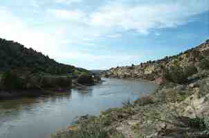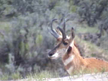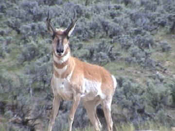

The Yampa River is the only free flowing major river in Colorado. The only time to run it is during spring runoff. Without the spring runoff you are likely to have to do a lot of walking through the shallows. This could be especially frustrating because this river twists and turns and goes in every direction conceivable before managing a short distance toward its destination..
In 1999 the "Colorado State Park - Yampa River " was established. State Park access points, most with camping, were established. Visit Yampa River Colorado State Parks site for details. When we did the Yampa on May 18, 2002, to take pictures for this web page, we planned on camping at South Beach and then paddling to the Juniper Canyon campsite. When we arrived at South Beach we were surprised to find that the signs said "DAY USE ONLY - NO CAMPING". We phoned the Yampa River State Park Headquarters and spoke to Eric, the Park Manager. He told us that they need to change the signs because all their brochures and website say that camping is allowed. We returned to South Beach and made camp.
Double Bridges is the furtherest upstream public access point of the Yampa River state park system. Paddling from there to South Beach is ranchland with plenty of trees and wildlife along the banks of the river. We paddled this section several times, years ago, early in the morning for the annual Craig's Father's Day Canoe Race. If you managed to be the lead boat you got to see all the wildlife along the banks. It's a beautiful run. When you get to the golf course just east of town you will encounter a small diversion dam with a chute in the middle. Descending the chute is fun for experts and challenging for beginners. After the golf course you will pass the county park, Loudy Simpson Park, which is an excellent access point to the river. Just west of town you will come to South Beach State Park.
From South Beach you will paddle through about 10 miles of ranchland before entering a canyon. The canyon continues almost all the way to Duffy Mountain state park. From there the river twists and turns through ranchland until it finally reaches Juniper Canyon state park. At this point the river enters a canyon that has a large diversion dam with a chute. The waves at the bottom of the chute will swamp a canoe. Juniper Canyon state park is upstream of the diversion dam. It looked to us that most locals were getting off the river at Duffy Mountain state park. All those miles of paddling through ranchland between Duffy Mountain and Juniper Canyon were a bit tedious but then most people don't paddle South Beach to Juniper Canyon all in one day at 2,000 cfs like we did.
The canyon then goes back into ranchland. Maybell Bridge state park is at the highway 40 bridge. From there the river continues through ranchland and then enters rolling hills. East Cross Mountain state park is the last state park. Downstream of this park is serious whitewater. The Moffat County Sheriff Department closes the river to all craft except kayaks when the flow exceeds 5000 cfs. I guess they got tired of rescuing parties that met with disaster at the higher water levels.
Animal Action Videos
No video below this point


South Beach - River Mile 140 Class I
Duffy Mountain - River Mile 108 Class I
Juniper Canyon - River Mile 95 Class I, II except for Class III diversion dam
Maybell Bridge - River Mile 90 Class I, II
East Cross Mountain - River Mile 61 (Class IV, V through canyon)
West Cross Mountain - River Mile 57 Class I
Deerlodge Park - River Mile 46 Class II, III (Permit Required)
Yampa Canyon Entrance - River Mile 45 Class II, III (Permit Required)
Confluence of Green River and Yampa River behind Steamboat Rock at Echo Park
River Mile 0 (Permit Required)
The Green River flows west after the confluence. Class II/III (Permit Required)