
MAP OF THE
WHITE RIVER AREA


Rangely
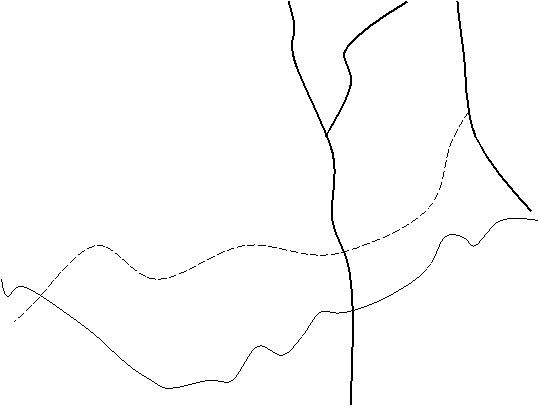


Uintah Ute
Reservation


BLM
Take-out

Bonanza

White River

Bridge

Put-In
Short
Dirt Road
To
Put-In

Camping under
south side of
Bridge
only—Porta-potty only.


Look closely for
this
intersection—not
well
marked—very small
Sign that
reads…
“BONANZA”
Directions to put-in: Take Colorado 64 out of Rangely
(bends to the northwest) for 12.5
miles. Watch closely & take
turnoff on the left. This is a hilly
and rather bumpy
road that may be difficult to drive
at night. You will come
to a T-intersection where you’ll turn
left to the river, about
1.5 miles. Cross over the bridge and
take the first little dirt
road on the right, down to the put-in. About 45 minutes
driving time from Rangely.
Directions to Rangely from
Denver:
Take I-70 west to Rifle. Hwy 13
north
to Meeker. Hwy 64 west to Rangely. Approximately 5.5 hours driving time.Fantasy
Canyon